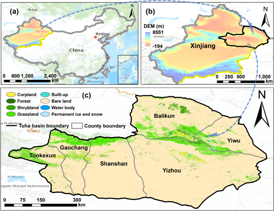
Oasis, as a predominant and distinctive resource in arid regions, plays an important role in maintaining land stability, human production and living activities. The research on oasis transition dynamics and driving factors owns vital significance in supporting arid regions sustainable development. As a typical mountain-desert-oasis landscape, Turpan-Hami (Tuha) Basin in Xinjiang of China, exhibits sophisticated interactions among different land types. In this study, we inspected the spatio-temporal patterns and transition processes of the oasis using a complex network during 1990 and 2020 in Tuha Basin. In the oasis transition network, degree value, betweenness centrality, and average path length were calculated to express the transition relationship, key oasis type, and oasis structural stability, corresponding. Six factors were selected to investigate the driving forces for oasis transition behind climate change and human activities. Our results showed that the oasis area of Tuha Basin, including natural oasis and artificial oasis, all grew from 1990 to 2020, with the natural oasis expanding more than the artificial oasis. The transitions between oasis types became more frequent as the number of the nodes increased throughout the study period. Grassland acted as the most important oasis type in the network with the highest betweenness centrality, but its importance declined due to the increasing complexity in the oasis transition network from 1990 to 2020. The transitions between oasis types became simpler and the oasis structural stability were increasingly unstable. Through the driving analysis, the oasis changes showed positive correlation with temperature ( P-value < 0.05, r = 0.88), and urbanization and industrialization factors prompted the transitions of built-up and cropland from grassland and shrubland. Totally, preventing the degraded grassland and excessive reclamation of land cover, protecting the shrubland and water resources are suggested in this study to conduct a harmonious symbiotic relationship between natural environment and human activities, and promote the oasis sustainable development.