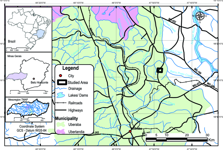
Human pressure on the water resources provided by natural wetlands has intensified in Brazil due to an increase in agricultural land equipped with irrigation. However, the amount of water stored in these areas, and its contribution to aquifer recharge is unknown. The objectives of this study were to determine the amount of water that can be retained in a natural wetland surrounded by farmland and to propose a model of groundwater recharge. We used remote sensing techniques involving Unmanned Aerial Vehicle (UAV) to map the area and highlight the wetland internal morphology, using RGB orthomosaic and its respective digital surface model. According to the topography of the study area, three compartments were defined. Compartment 1, corresponding to the external border of the wetland, can store 313,121.00 m³ of water; compartment 2 and 3 can store 85,923.20 m³ and 17,952.10 m³, respectively. The 2D inversion and a pseudo-3D model produced from Electrical Resistivity Tomography (ETR) data were used to visualize the subsurface geologic structure and hydrologic flow paths. Our results showed the direct interactions between groundwater (GW) and surface water (SW) in the center of the wetland (compartment 3), which constitutes the aquifer recharge zone with vertical infiltration. As the depth increases, infiltration and water flow deviate laterally in the southwest and northeast direction. The wetland is characterized as an unconfined aquifer that plays an important role in the hydrogeological dynamics of the catchment. Remotely sensed very high-resolution images allied with geophysical techniques allowed complete surface and subsurface imaging and offered visual tools that contributed to understanding the hydrodynamics of the wetland.