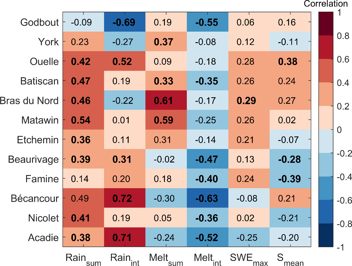
Seasonal forecasting of spring floods in snow-covered basins is challenging due to the ambiguity in the driving processes, uncertain estimations of antecedent catchment conditions and the choice of predictor variables. In this study we attempt to improve the prediction of spring flow peaks in southern Quebec, Canada, by studying the preconditioning mechanisms of runoff generation and their impact on inter-annual variations in the timing and magnitude of spring peak flow. Historical observations and simulated data from a hydrological and snowmelt model were used to study the antecedent conditions that control flood characteristics in twelve snow-dominated catchments. Maximum snow accumulation (peak SWE), snowmelt and rainfall volume, snowmelt and rainfall intensity, and soil moisture were estimated during the pre-flood period. Stepwise multivariate linear regression analysis was used to identify the most relevant predictors and assess their relative contribution to the interannual variability of flood characteristics. Results show that interannual variations in spring peak flow are controlled differently between basins. Overall, interannual variations in peak flow were mainly governed, in order of importance, by snowmelt intensity, rainfall intensity, snowmelt volume, rainfall volume, peak SWE, and soil moisture. Variations in the timing of peak flow were controlled in most basins by rainfall volume and rainfall and snowmelt intensity. In the northernmost, snow-dominated basins, pre-flood rainfall amount and intensity mostly controlled peak flow variability, whereas in the southern, rainier basins snowpack conditions and melt dynamics controlled this variability. Snowpack interannual variations were found to be less important than variations in rainfall in forested basins, where snowmelt is more gradual. Conversely, peak flow was more sensitive to snowpack conditions in agricultural basins where snowmelt occurs faster. These results highlight the impact of land cover and use on spring flood generation mechanism, and the limited predictability potential of spring floods using simple methods and antecedent hydrological factors.