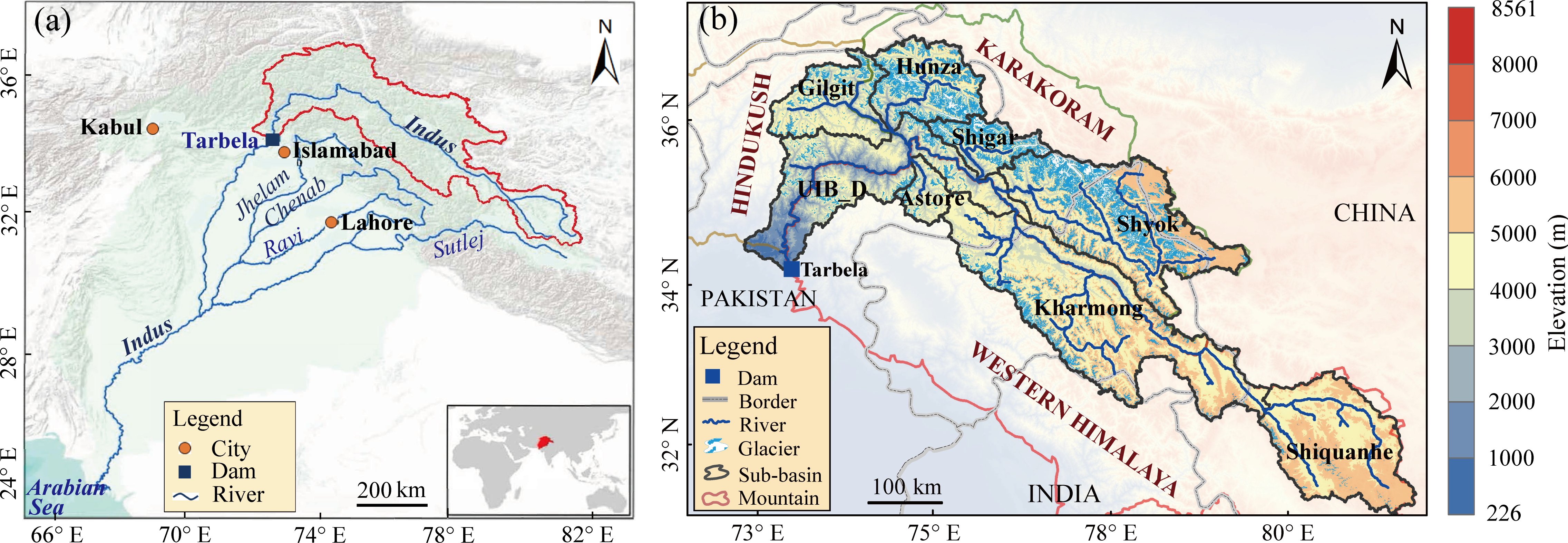
Ice reserve estimates is a fundamental prerequisite for the water resources management, the upper Indus river basin (UIB) possesses the most abundant mid-latitude ice resources outside the poles. However, the ice reserve estimates remain unclear due to limited accessibility. We validated the critical parameters of the GlabTop2 model through ground-penetrating radar (GPR) measured ice thickness, compared the plots and profiles of the GPR-measured ice bed elevation versus GlabTop2-estimated results, integrated with GlabTop, Volta model, and the inverse distance weighted (IDW) interpolated results on various sized glaciers, a reasonable parametric scheme (τ =120 kPa and f = 0.8) of GlabTop2 was selected to apply on vast amounts of glaciers in the UIB region. GlabTop2 estimates indicated that the ice thickness of the UIB was varying from 0 to 488.1 m, with an average value of 74.4 m. Significant spatial heterogeneity exists in the sub-basins, Shyok, Shigar, and Hunza high-altitude sub-catchments own the most abundant ice reserve, less quantity was stored in the Western Himalaya and Hindukush ranges, which accounts for a small proportion (11.3% and 6.9%, respectively). A total of 1269.7 km3 ice volume can be converted to 1142.7 km3 water resources, and it can supply at least 16.1 y for the Besham hydrological station as runoff without considering the glacier process and other variables. The UIB relies on the glacier melting of the midstream because they are keeping in a self-sufficient state, in contrast, it will be up against water shortage in the future evenly, especially for the upper reaches and downstream area. Our estimates will provide the baseline information for water resources planning and management of the Indus river.