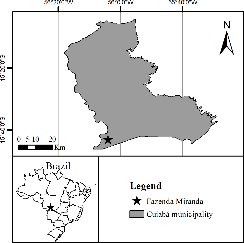
Since the Brazilian Cerrado has been heavily impacted by agricultural activities over the last four to five decades, reference evapotranspiration (ETo) plays a pivotal role in water resources management for irrigation agriculture. The Penman-Monteith (PM) is one of the most accepted models for ETo estimation, but it requires many inputs that are not commonly available. Therefore, assessing the FAO guidelines to compute ETo when meteorological data are missing could lead to a better understanding of how climatic variables are related to water requirements and atmospheric demands for a grass-mixed savanna region and which variable impacts the estimates the most. In this study, ETo was computed from April 2010 to August 2019. We tested twelve different scenarios considering radiation, relative humidity, and/or wind speed as missing climatic data using guidelines given by FAO. When wind speed and/or relative humidity data were the only missing data, the PM method showed the lowest errors in the ETo estimates and correlation coefficient (r) and Willmott’s index of agreement (d) values close to 1.0. When radiation data were missing, computed ETo was overestimated compared to the benchmark. FAO procedures to estimate the net radiation presented good results during the wet season; however, during the dry season, their results were overestimated, especially because the method could not estimate negative Rn. Therefore, we can infer that radiation data have the highest impact on ETo for our study area and also regions with similar conditions and FAO guidelines are not suitable when radiation data are missing.
Despite a substantial effect of reference evapotranspiration (ETref) in irrigation practices and hydrological processes, trends and the causes of such trends in ETref are scarcely investigated in Bangladesh. The spatiotemporal trends in ETref, climatic factors influencing the variations in ETref were investigated based on daily climate datasets from 18 sites during 1980-2017. Modified Mann-Kendall, linear regression, Morlet wavelet analysis (MWA) and cross wavelet transform model were employed to appraise temporal variations in ETref and the influential climatic variables. The empirical Bayesian kriging model was used to understand the spatial variations of ETref on the annual and seasonal time scales. The stepwise regression and partial correlation coefficient (PCC) were adopted to identify factors influencing the variations in ETref. The analysis showed a decrease in annual (-1.19 mm/year) and seasonal (-0.40 mm/decade for pre-monsoon, -0.47 mm/decade for post-monsoon, -0.50 mm/decade for winter) ETref except for monsoon in Bangladesh which is similar to “evapotranspiration paradox” observed in some locations. Results of trend analysis also revealed that though a rise in mean temperature (MT), a significant decline in sunshine duration (SD) and wind speed (WS) are the major causes of the decrease in ETref. Spatially, the higher annual ETref was found in the southwestern region while the lower ETref was detected in the northwestern region. The significant periods of 1-3 and 3-5-year cycles were detected in the annual and seasonal ETref. The results exhibited a significant coherence between ETref with climatic variables at various time-frequency bands. Stepwise regression and PCC showed that the effect of climatic variables on ETref differs on the annual and seasonal scales whereas MT, RH, and SD mainly attributed to the variations ETref in Bangladesh. These outcomes are anticipated to be beneficial for irrigation designing a sustainable water practice considering the effects of climate change and anthropogenic contributions.