Brianna Corsa

and 4 more

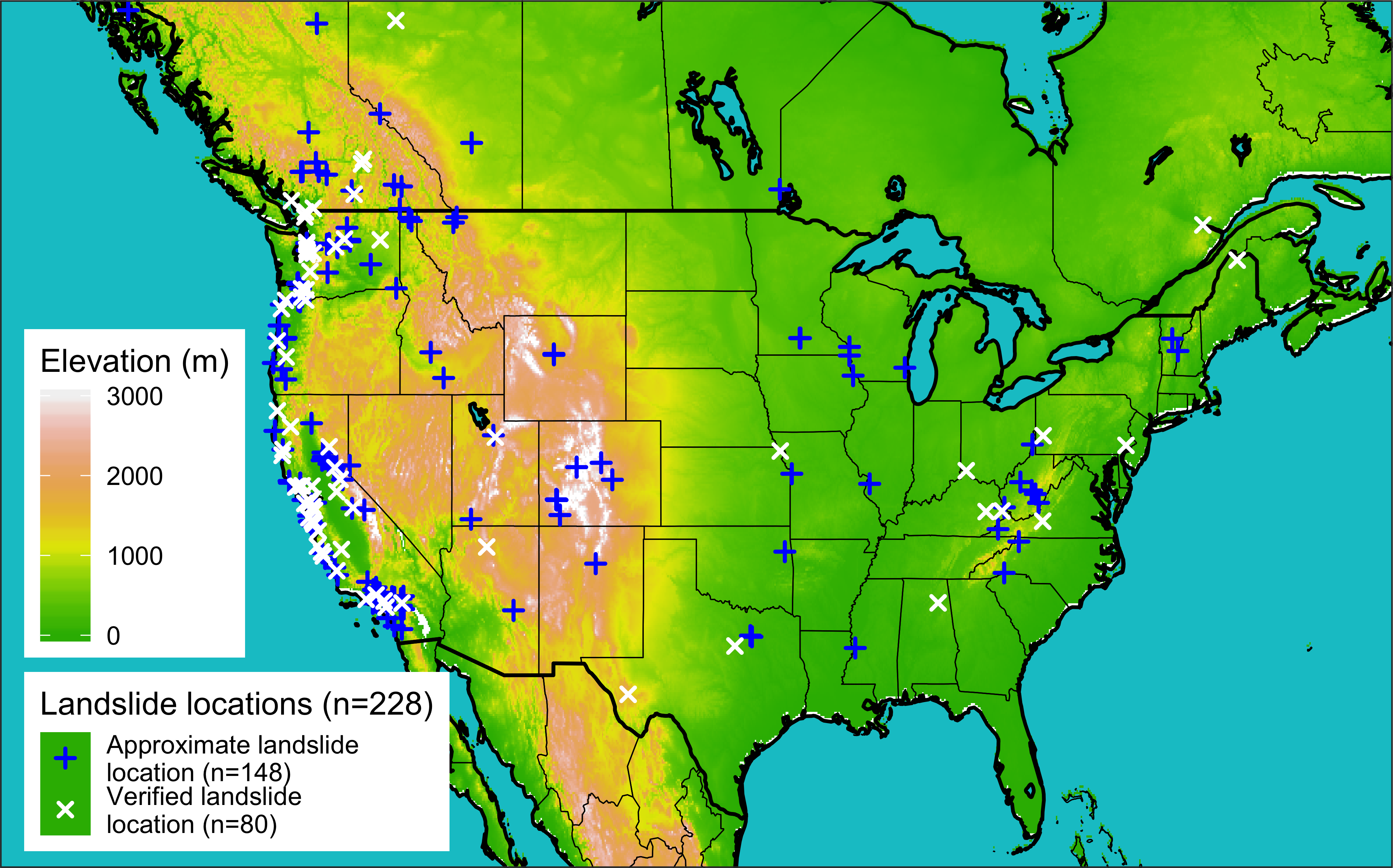
The GeoSciFramework project (GSF), funded by the NSF Office of Advanced Cyberinfrastructure and NSF EarthCube programs, aims to improve intermediate-to-short term forecasts of catastrophic natural hazard events, allowing researchers to instantly detect when an event has occurred and reveal more suppressed, long-term motions of Earth’s surface at unprecedented spatial and temporal scales. These goals will be accomplished by training machine learning algorithms to recognize patterns across various data signals during geophysical events and deliver scalable, real-time data processing proficiencies for time series generation. The algorithm will employ an advanced convolutional neural network method wherein spatio-temporal analyses are informed both by physics-based models and continuous datasets, including Interferometric Synthetic Aperture Radar (InSAR), seismic, GNSS, tide gauge, and gas-emission data. The project architecture accommodates increasingly large datasets by implementing similar software packages already proven to support internet searches and intelligence gathering. This talk will focus primarily on the Differential InSAR (DInSAR) time-series analysis component, which quantifies line-of-sight (LOS) ground deformation at mm-cm spatial resolution. Here, we compare time series products generated under three different processing techniques. The first, an automated version of InSAR processing using the small baseline subset (SBAS) method performed in parallel on systems such as Generic Mapping Tool SAR (GMT5SAR) and the Generic InSAR Analysis Toolbox (GIAnT). The second method will resemble the first but will implement different processing systems for performance comparison using the InSAR Scientific Computing Environment (ISCE) and the Miami InSAR Time Series Software in Python (MintPy). The final strategy, developed by Drs. Zheng and Zebker from Stanford University, concentrates on the topographic phase component of the SAR signal so that simple cross multiplication returns an observation sequence of interferograms in geographic coordinates [Zebker, 2017]. Our results provide high-resolution views of ground motions and measure LOS deformation over both short and long periods of time.

Elsa Culler

and 5 more

Extreme precipitation can have profound consequences for communities, resulting in natural hazards such as rainfall-triggered landslides that cause casualties and extensive property damage. A key challenge to understanding and predicting rainfall-triggered landslides comes from observational uncertainties in the depth and intensity of precipitation preceding the event. Practitioners and researchers must select among a wide range of precipitation products, often with little guidance. Here we evaluate the degree of precipitation uncertainty across multiple precipitation products for a large set of landslide-triggering storm events and investigate the impact of these uncertainties on predicted landslide probability using published intensity-duration thresholds. The average intensity, peak intensity, duration, and NOAA-Atlas return periods are compared ahead of 228 reported landslides across the continental US and Canada. Precipitation data are taken from four products that cover disparate measurement methods: near real-time and post-processed satellite (IMERG), radar (MRMS), and gauge-based (NLDAS-2). Landslide-triggering precipitation was found to vary widely across precipitation products with the depth of individual storm events diverging by as much as 296 mm with an average range of 51 mm. Peak intensity measurements, which are typically influential in triggering landslides, were also highly variable with an average range of 7.8 mm/hr and as much as 57 mm/hr. The two products more reliant upon ground-based observations (MRMS and NLDAS-2) performed better at identifying landslides according to published intensity-duration storm thresholds, but all products exhibited hit-ratios of greater than 0.56. A greater proportion of landslides were predicted when including only manually-verified landslide locations. We recommend practitioners consider low-latency products like MRMS for investigating landslides, given their near-real time data availability and good performance in detecting landslides. Practitioners would be well-served considering more than one product as a way to confirm intense storm signals and minimize the influence of noise and false alarms.