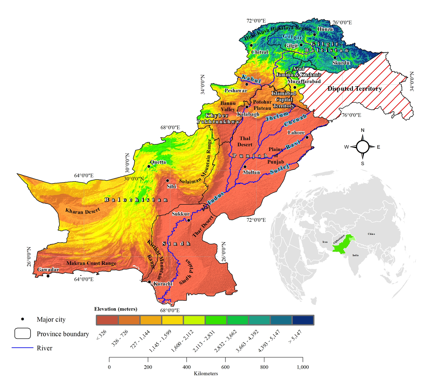
Abrupt changes in climatic factors, exploitation of natural resources, and land degradation contribute to soil erosion. This study provides the first comprehensive analysis of annual soil erosion dynamics in Pakistan for 2005 and 2015 using publically available climatic, topographic, soil type, and land cover geospatial datasets at 1 km spatial resolution. A well-accepted and widely applied Revised Universal Soil Loss Equation (RUSLE) was implemented for the annual soil erosion estimations and mapping by incorporating six factors; rainfall erosivity (R), soil erodibility (K), slope-length (L), slope-steepness (S), cover management (C) and conservation practice (P). We used a cross tabular or change matrix method to assess the annual soil erosion (ton/ha/year) changes (2005-2015) in terms of areas and spatial distriburtions in four soil erosion classes; i.e. Low (<1), Medium (1–5], High (5-20], and Very high (>20). Major findings of this paper indicated that, at the national scale, an estimated annual soil erosion of 1.79 ± 11.52 ton/ha/year (mean ± standard deviation) was observed in 2005, which increased to 2.47 ±18.14 ton/ha/year in 2015. Among seven administrative units of Pakistan, in Azad Jammu & Kashmir, the average soil erosion doubled from 14.44 ± 35.70 ton/ha/year in 2005 to 28.03 ± 68.24 ton/ha/year in 2015. Spatially explicit and temporal annual analysis of soil erosion provided in this study is essential for various purposes, including the soil conservation and management practices, environmental impact assessment studies, among others.